The Society of Urban Perambulators (SoUP) grew from around 20 members to more than 90 in less than a month in anticipation of our latest tour through the warehouse district of the Portland Neighborhood in northwest Louisville. We had approximately 30 people attend the tour along with a host of folks living and working in the neighborhood who dropped in at different points along the route.
We began at one of my favorite “third places” in Louisville, McQuixote Books & Coffee. McQuixote opened its doors in 2014 at this location within the larger compound on Portland Avenue now known as FifteenTwelve. Mickey Ball, the owner and barista greeted everyone and helped get the attendees caffeinated before we explored FifteenTwelve and headed out for the rest of the walkabout.


FifteenTwelve is a cluster of buildings, mostly a series of warehouse structures attached to each other. At one time the space was a fabrication shop, art studios and gallery, and a music and events venue among other uses. Just recently the metal and wood working artists of RockerBuilt purchased the compound to utilize as their fabrication studios as well as realize a broader vision to create an ecosystem of shops and offices along with a music venue. The music and events venue is almost complete and many of the studio and office spaces around the compound have new tenants bringing new life to what was only Mickey for quite some time.


Once we heard a bit about the building and RockerBuilt, we headed east towards one of my favorite intersections in the entire city at the corner of Lytle and 15th Street. If you are standing in the right spot, it reminds me of a scene in DUMBO Brooklyn, circa 1990s… the last time I was there. Four historic warehouses frame the intersection and create the sense of an urban industrial spot that is unlike anything else in the city. There is so much potential right there.


Speaking of potential, we didn’t stop just to look at the views, on the northeast corner of the intersection is a collection of three historic warehouses that are slated to become the Audubon. Gregg Rochmann, one of the developers on the project was on hand to give the perambulators some insight into the vision, which will be a mixed-use development with 61 apartments, a mix of studio, one- and two-bedroom units. I believe he mentioned that rents will start around $600. The east-facing wall will look out onto Waterfront Park Phase 4 which is slated to begin development in the next few years as MSD work wraps up on the site.


From there we headed south on 15th and rounding the corner at 15th you presented with a great example of the interesting and sometimes unexpected streetscapes you get when different street grid systems come together. The main Louisville grid that is about 8 degrees off true north-south runs into the historic streets of the Portland and Shippingport grids which appear to have been aligned perpendicular to the river, which changes as the river bends. These offset grids create a triangular wedge open space framed by historic brick warehouses with a unique little two-story building in the center on the front edge that would make a great cafe or other shop where patrons could sit outside and enjoy the unique urban space.


The buildings to the north were once a clothing manufacturer and then a Coca Cola bottling company and now home to KFI Studios a furniture manufacturer. The buildings along the south were part of a sprawling Avery & Son’s Plow Manufacturing complex back in the early 1900s.


Just beyond the triangular open space is the new University of Louisville’s Portland MFA Studio for the Hite Institute, Archaeology, and Urban Design Studios in a former tobacco warehouse and at one point in time a facility that stored government cheese Gregg mentioned. I’ve been working out of this building since we moved the UDS from downtown Louisville back in early 2019. The space is a great adaptive reuse and getting to know our new neighborhood has been a great experience.


After a quick tour inside the UofL facility we continued west, southwest to Main Street at 17th Street. It is at this point that the more industrial setting starts to give way to more fine grain urbanism forms with a mix of residential homes, smaller workshops and storefront buildings. This was not the case in 1905 however. I specifically went to Main Street at this point so everyone could see the empty blocks along the south side of Main. At one point monumental buildings stood between 17th and 19th, homes to Senn & Archerman Brewery and the American Tobacco Company. The widespread demolition of buildings along this stretch and also on Market Street one block south leaves the area with a much different character than a century ago where this neighborhood would have appeared as a much more dense and active part of town. The super-wide one-way Main Street and wide open spaces gives this stretch a very sleepy feel, that is not altogether a terrible thing.


Continuing west, we reached 20th and Main Street. On the northeast corner sits the historic US Feather Duster Factory (according to 1905 Sanborn maps). More recently (within the last 30 years) the building was Margie’s Place, a corner bar, based on the ghost sign on the wall. Our friend and Portland resident Caleb purchased the building a few years ago and has been working to restore it. He has started with gutting the upper two floors to eventually create a residential unit, shedding several dumpsters of plaster and junk that had accumulated in the entire building. He is not sure what he wants to do with the first floor but understands the great value of corner store buildings to the urban fabric and would like it to contribute to the local community.


A block west from Margie is the Portland Orchard Project. Local resident and urban agriculturalist Valerie Magnuson was on hand to talk with the perambulators about the initiative while a group were tending to the orchard trees, pruning and cleaning them up. The community orchard sits on about .6 acres and began as an effort to strengthen neighborhood cohesion and provide fresh produce to the local residents. The orchard’s trees are ten years old and bear fruit. There are plans to add additional trees and other plantings this year, including Paw Paws.


We meandered around the block as we began to head back to our starting point. Though I’ve been focusing on what we saw, one of the best things about these neighborhood explorations is the conversations you have along the way. One of my favorite things to do is explore new cities and neighborhoods and it doesn’t get much better than with fellow urbanists who provide added layers of insight into what we are seeing. It was around this point in the walk that I had the good fortune to catch up and chat with Mose Putney about the great corner store buildings in the area and the park we were approaching.
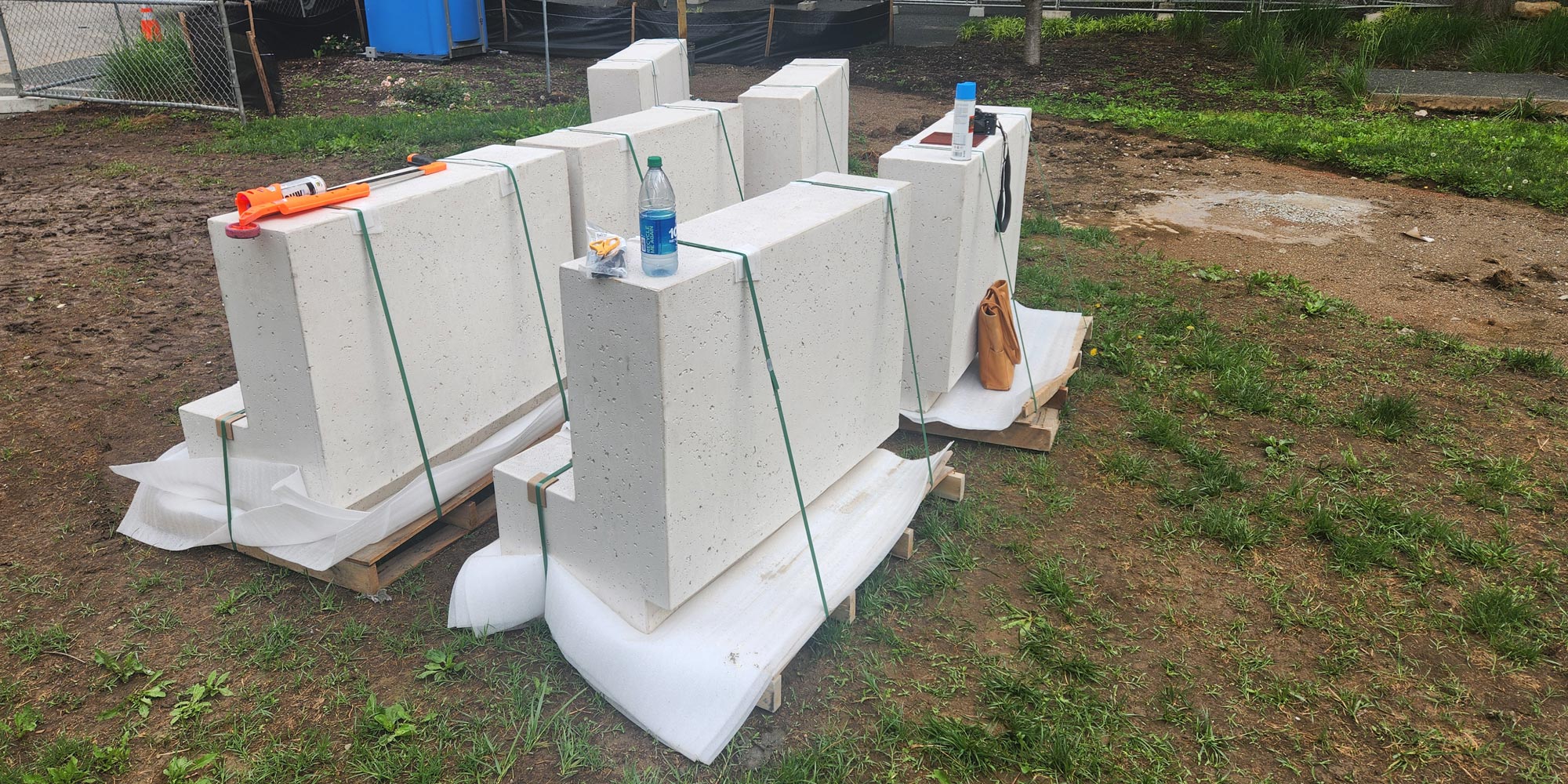
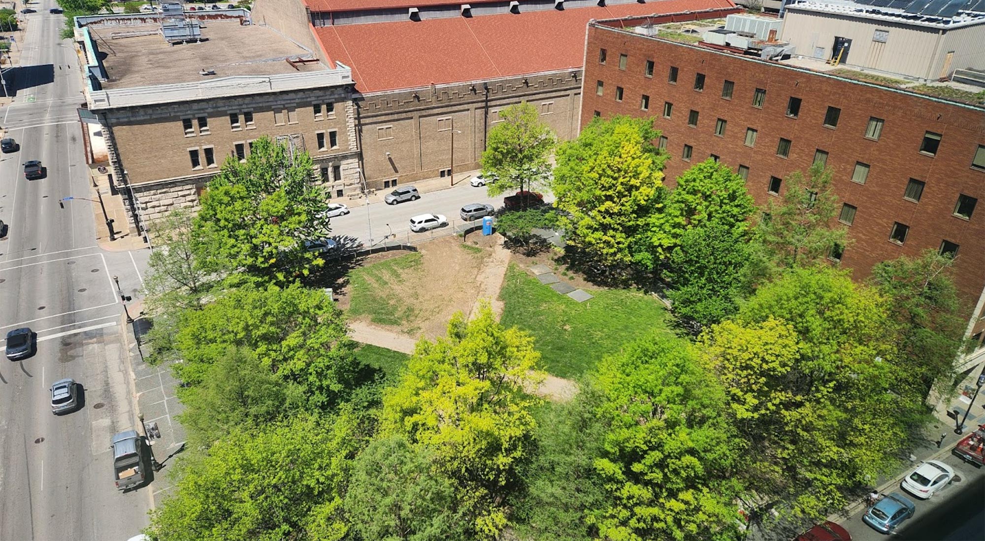
Boone Square Park is one of the first and smallest parks in Louisville designed by Frederick Law Olmsted. According to the Olmsted Parks Conservancy website “It also has the distinction of being the location of the first organized baseball game in Louisville in 1865.” A few days before this perambulation I was reading The Nearly Forgotten History of Portland, Kentucky by Jim Higdon. There was a memorable section that described the interesting machinations of the people of the time when this park came to be, as it was originally deeded to the city by Eliza Boone in 1891. I’m glad she donated the land as the park is only a few blocks from the Urban Design Studio and I sometimes walk down to do some writing or other work to enjoy the space. The four-acre park is a city block framed by homes and a few corner store buildings. It reminds me vaguely of the squares of Savannah that I used to spend a lot of time in, though Boone Square is much larger and the low surrounding buildings don’t quite create the atmosphere of an outdoor room.

One of the interesting aspects of the street network in the area are the fairly narrow sub-streets, something between an alley and the average local residential street. These streets clock in around 20 feet wide with houses fairly close to the road. These streets help create density while maintaining the character of the neighborhood gently packing more houses in a block than many other areas of town. A good illustration can be found along Owen Street as we headed towards the Pilot Building which serves as an amazing terminating vista from multiple vantage points at 17th and Bank Street.

The Pilothouse, whose name is a nod to the river culture of Portland, was designed by architect Mose Putney, and is a new mixed-use development, possibly the first of its kind to be built in the neighborhood in more than 50 years. The project is a reimagining of the corner store and sits on a prominent quarter acre site where a jog in Bank Street and again where two street grid systems come together makes this three story building visible from many different vantage points. The first floor will be office and retail while the upper floors will be apartments. On the top corner balcony of the building sat a cedar tree. Mose explained that in the Norse tradition, a tree was ceremonially placed at the top of a structure commonly called Topping Out to honor the trees that had been used in a building's construction. These are the kind of tidbits of information that make the walks so interesting and memorable.

We began making our way back to McQuixote, passing another historic corner store building at Lytle and 17th Street. The storefront has seen better days, but it could be an amazing asset to the neighborhood's revitalization if it were rehabilitated to its once historic beauty. Ironically, one can imagine the future possibilities of Portland from the historic images found at the University of Louisville’s Archives.


At this point in the walk we stopped at our starting point and offered the group one last stop, an optional extended tour to Against The Grain Brewery on Northwestern Parkway. A smaller group of adventurous perambulators peeled off and walked the short distance to the local brewery whose beer is distributed around the world. We were greeted by one of the owners, Sam Cruz, who offered the travelers a selection of beers (for purchase… cannot give alcohol away), and then we got a great brewery tour and background on their beer making process. A great way to end another great Society of Urban Perambulators event.


Thanks to the many people who attended and a special thanks to all the people living and working in the neighborhood who took time to tell us about their corner of Louisville and the great things going on in the community. The Portland Neighborhood is so vast and interesting we definitely will need to come back this way and explore other parts of this historic neighborhood on future Society of Urban Perambulator events. Looking forward to our next adventure, meeting and hearing from the great people in our community working to make the city a better place.
The following are some maps of the walking tour, both current day and from Louisville in 1905.